Overview · Calgary, AB

Beltline, Calgary

Neighbourhood data across five lenses. 30 dissemination areas. Population approximately 25,269. Updated 2026.

At a glance

Tap any lens to jump to its data. Each is a 0 to 100 score versus other Calgary neighbourhoods.

Notable in this neighbourhood
Easy to get around.Accessibility scores 90/100, the top quintile of Calgary.
Low mapped climate risk.Climate scores 76/100, the fourth quintile of Calgary.
An affordable corner of Calgary.Property Value scores 27/100, the bottom quintile of Calgary.

Safety

Police access
87
Fire access
84
Health access
80
Lighting
22
Traffic
14
Low crime
5
Quiet
0

Beltline scores 31/100 on safety, the 7th percentile of Calgary neighbourhoods (city median 48). Its strongest signal is fire-service access.

Ask: "How does Beltline's safety compare to the rest of Calgary?"

Property Value

Development
60
Renovation
54
Rental
44
Growth
7
Median value
5

Beltline scores 27/100 on property value, the 1st percentile of Calgary neighbourhoods (city median 52). Its strongest signal is rental supply.

Ask: "What's the price trend for homes in Beltline?"

Accessibility

Dining
99
Transit
98
Grocery
98
Health
97
Retail
95
Recreation
85
Schools
78
Trails
61

Beltline scores 90/100 on accessibility, the 97th percentile of Calgary neighbourhoods (city median 44). Its strongest signal is retail access.

Ask: "What's the commute from Beltline to downtown Calgary?"

Climate

Mapped climate risk index: 24/100

Beltline scores 76/100 on climate, the 33rd percentile of Calgary neighbourhoods (city median 79).

Ask: "What's the climate risk for a specific address in Beltline?"

Census

Commute
96
Density
95
Employment
87
Culture
69
Income
61
Equality
23
Dwelling value
16

Beltline scores 63/100 on census, the 88th percentile of Calgary neighbourhoods (city median 50). Its strongest signal is population density.

Ask: "Who lives in Beltline?"

Map

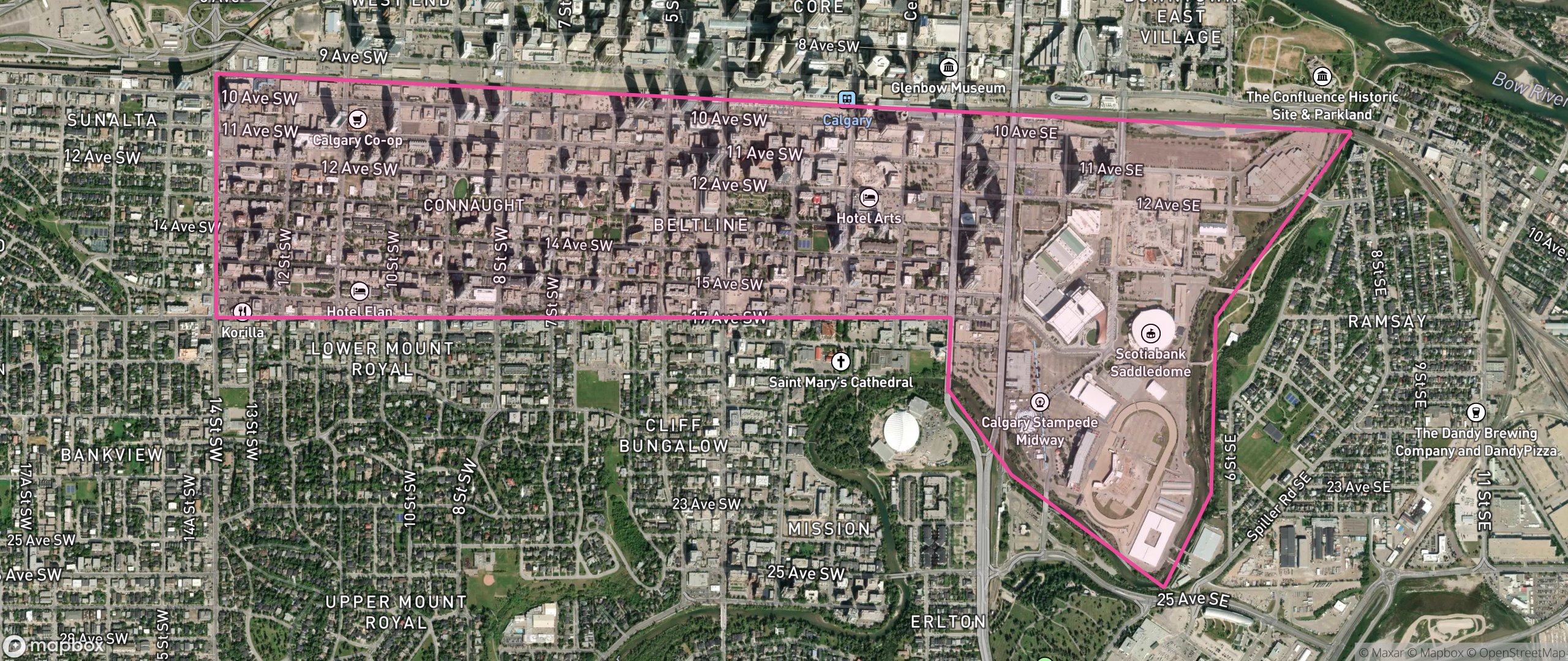
Map of Beltline, Calgary showing the community boundary

Frequently asked

What is Beltline like as a neighbourhood?
Beltline scores 56/100 overall in Calgary, a composite of the four decision lenses (safety, property value, accessibility, and climate); census data is shown as context. It is strongest on accessibility.
What does Beltline score best on?
Beltline's standout lens is accessibility, at 90/100, the 97th percentile of Calgary neighbourhoods.
How are Beltline's scores calculated?
Each lens is a 0 to 100 weighted composite of percentile-ranked sub-components, computed from population-weighted dissemination-area data. Because it is a weighted blend rather than a rank, a score of 60 does not mean "better than 60% of neighbourhoods": the percentile figures on this page state that standing separately. Higher is better, except climate which reflects mapped hazard exposure.

Nearby neighbourhoods

Beltline 3D tour preview
Neighbourhood tour
Fly through Beltline in 3D

A 60-second cinematic flythrough of the places that shape daily life here. No account needed.

Start the tour
Calgary shortlists
Updated
May 15, 2026
Coverage
Calgary: 300+ neighbourhoods scored
Not sure Beltline is the right fit?

Take the 60-second match quiz, answer 6 questions and the data suggests a Calgary neighbourhood that fits your priorities and budget.