Calgary's 15-Minute Neighbourhoods: Where the Data Says the Math Works
Most Calgarians drive. In the 2021 census, about 83% of Calgary commuters got to work by car, as a driver or a passenger, up from 76% in 2016. Part of that is a pandemic artifact (2021 was the year roughly a quarter of workers stayed home), but the underlying shape is older than COVID: Calgary was built around the automobile. As University of Calgary public-health researcher Gavin McCormack puts it, "Calgary is very much a city designed for automobiles. It took many decades of development to get to where we are now."
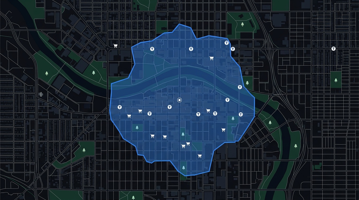
The city is not uniform, though. In a handful of inner-city communities, a 15-minute walk genuinely reaches groceries, transit, a park, and a clinic. That is not a slogan. It is a measurable threshold, and you can test any address against it. So we did. We scored all 240 Calgary communities on PickYourPlace's Accessibility lens. Eleven clear a strict bar. The catch is that the names that pass are not quite the ones the city's walkability reputation would predict.
The short version. Of 240 scored Calgary communities, 11 score 85 or higher out of 100 on accessibility, the top 5% of the city: the downtown core, Eau Claire, Sunnyside, Beltline, Sunalta, Hillhurst, and a few of their inner-city neighbours. Walkability and safety pull against each other here (the two lenses correlate negatively, r = -0.3), so the most walkable communities tend to score below the city's safety median. And two of Calgary's most famous "walkable" names, Bridgeland and Inglewood, do not actually clear the bar.
Draw a 15-minute walk on any address →
What a 15-Minute Neighbourhood Actually Is
The "15-minute city" is a planning idea introduced in 2016 by Carlos Moreno, a researcher at Université Paris 1 Panthéon-Sorbonne. His proposal: residents should be able to meet six everyday needs, living, working, supplying, caring, learning, and enjoying, within a 15-minute walk or bike ride of home.
The concept is older than its branding. University of Calgary planning professor Francisco Alaniz Uribe traces it back "to the 1930s with the idea of the neighbourhood unit concept, where we have at the centre of the neighbourhood, within a radius of walkability, the school and the main services citizens require in their daily lives." What is new is the urgency. Climate, congestion, and the cost of sprawl have moved the idea from design seminars into municipal policy, including in Calgary. The City's Municipal Development Plan uses the language of "complete communities" to describe almost exactly what Moreno's framework prescribes: a mix of housing, jobs, retail, services, and recreation reachable without a long car trip. That is the policy. The question this post asks is which communities are actually there yet.
"It's a slow process and there are so many players involved. It's not just the city with a municipal plan, you have the developers, the real estate industry, the communities, the residents, political will. It's very complex. But we're moving in the right direction."
Dr. Gavin McCormack, University of Calgary
How We Measured It
A walkability number is only as honest as the geometry behind it. The most-quoted figure in this conversation, Walk Score, draws a distance-decay function around an address, but its "walking" radius is not real walking: it does not know about cul-de-sacs, freeways, or rivers. A river-edge address in Calgary can post a strong Walk Score off stores inside a one-kilometre circle even when half that circle is the Bow. Calgary's citywide Walk Score is 39, which it labels "car-dependent." (Walk Score is a United States proprietary index, useful here only as a contrast.)
We work differently. PickYourPlace's Accessibility lens counts the everyday destinations reachable on foot from a community, transit stops, groceries, restaurants, schools, health services, recreation, retail, and trails, then scores each community from 0 to 100 against the rest of Calgary, where the citywide median lands in the mid-40s and only a handful of communities reach the high 80s and 90s. The scores are relative to Calgary, not some abstract international benchmark. (The full scoring method is documented in how neighbourhood scoring works.) On the Explore map, the isochrone tool goes one step further: it draws the real area you can walk in 15 minutes along Calgary's street network, using a Valhalla routing engine over OpenStreetMap data, so rivers, rail lines, and dead ends cut the shape the way they cut your actual walk.
For this post we test four of Moreno's six functions, the four that genuinely separate Calgary communities at the neighbourhood scale:
- Groceries: a full-service grocery store within reach on foot.
- Transit: a CTrain station or high-frequency bus service.
- Greenspace: a park, pathway, or open recreational space.
- Healthcare: a clinic, urgent care, or hospital.
Schools and workplaces are present almost everywhere in inner Calgary, so they do not separate the strong from the weak the way the four above do.
The 11 Calgary Communities That Pass, and Where the Famous Names Land
Here is the full ranking: the eleven communities that clear a strict accessibility bar (a score of 85 or higher out of 100), the two that come close, and the two famously walkable names that fall short when you measure honestly.
| Community | Access | Transit | Safety | Median value | Verdict |
|---|---|---|---|---|---|
| Downtown Commercial Core | 94 | 99 | 36 | $147,000 | Passes |
| Downtown West End | 94 | 98 | 46 | $37,000 † | Passes |
| Eau Claire | 92 | 99 | 58 | $37,000 † | Passes |
| Chinatown | 92 | 99 | 51 | $308,500 | Passes |
| Sunnyside | 91 | 97 | 57 | $375,500 | Passes |
| Beltline | 90 | 98 | 31 | $234,000 | Passes |
| Sunalta | 89 | 84 | 33 | $268,500 | Passes |
| Hillhurst | 88 | 90 | 40 | $499,500 | Passes |
| Lower Mount Royal | 87 | 96 | 38 | $298,000 | Passes |
| Bankview | 87 | 86 | 39 | $330,500 | Passes |
| Cliff Bungalow | 85 | 94 | 45 | $779,000 | Passes |
| Crescent Heights | 84 | 93 | 37 | $399,500 | Close |
| Mission | 79 | 87 | 31 | $260,500 | Close |
| Bridgeland/Riverside | 67 | 55 | 30 | $365,500 | Falls short |
| Inglewood | 32 | 17 | 39 | $388,500 | Falls short |
Access, Transit, and Safety are 0-to-100 lens scores relative to Calgary's 240 communities (higher is stronger; on safety, higher is safer). For scale, the citywide median is about 44 on accessibility and 48 on safety. Median value is the 2026 median assessed value across all parcels in the community. † In Eau Claire and Downtown West End, titled parking and storage units make up more than half of assessed parcels, so the all-parcel median sits far below a typical condo price.
Two things stand out before the deep dives.
First, the gap between reputation and measurement is larger than the marketing language suggests. Inglewood, cited on nearly every walkable-Calgary list, scores 32 out of 100 for accessibility and 17 for transit. Eau Claire and Sunnyside, which rarely top those lists, score 92 and 91.
Second, the trade-off is real and it is in the numbers. Across all 240 communities, accessibility and safety correlate negatively (Pearson r = -0.29, and -0.32 once you drop the smallest communities). The most walkable places tend to score below the city's safety median. There are exceptions, and they matter, but the pattern is consistent enough to call a pattern.
Compare any two communities side by side →
The Communities That Actually Pass
Beltline: the dense, affordable one
Beltline is the proof that Calgary can do density. It is the city's largest inner-city community (about 25,000 residents) and it clears the bar with an accessibility score of 90 out of 100, and transit at 98. From a typical Beltline address, grocery, health, and recreation access all land in the high 90s, and downtown is reachable on foot, not just by train. The price is the surprise: the median assessed value across all Beltline parcels is $234,000, the lowest entry point on this list, because more than half the housing stock is high-rise condo.
The trade-off is safety. Beltline's safety score is 31 out of 100, among the lowest in the city (the median is 48), and it records the highest raw incident volume in the city: about 1,365 reported incidents in 2025, or 54 per 1,000 residents. That volume tracks density, nightlife, and commercial activity more than personal risk, and the figure is real, so it belongs in the decision. We unpack what Beltline's crime data does and does not mean in a separate post. Demographically it is young (median age 34) and renter-heavy (74% renters). For a fuller picture, see the Beltline neighbourhood guide.
Kensington (Hillhurst and Sunnyside): the balanced one
"Kensington" colloquially covers two scored communities along Kensington Road NW: Hillhurst (accessibility 88) and Sunnyside (91). Together they are the version of 15-minute Calgary that actually balances the lenses. The commercial strip handles groceries, pharmacy, and daily errands on foot. Sunnyside CTrain sits on the eastern edge. Riley Park and the Bow River pathway fall inside most residents' walking radius, and Sunnyside's recreation data shows roughly 42 facilities and 42 kilometres of trail reachable on foot.
What sets Kensington apart is that it clears the accessibility bar without bottoming out on safety. Sunnyside scores 57 on safety, above the city median of 48, and Hillhurst 40, just below it, both well above Beltline's 31. Prices reflect the balance: Sunnyside's median assessed value is $375,500 and Hillhurst's is $499,500, well above Beltline. For anyone weighing Calgary against Vancouver, Sunnyside is the city's closest data cousin to Kitsilano and Mount Pleasant, a comparison we run in the Vancouver-to-Calgary guide. See the Kensington neighbourhood guide for the full profile.
The genuine surprises: Eau Claire, Sunalta, and the downtown core
The communities most people leave off their walkable shortlists are the ones the data rates highest.
Eau Claire scores 92 on accessibility and, unusually, 58 on safety. It is the rare Calgary community that is both highly walkable and above the safety median, with the riverfront, the festival grounds, and the west end of downtown all a short walk away. Its all-parcel median assessed value reads $37,000 only because titled parking and storage units outnumber condos in the assessment roll; the actual homes are high-rise units.
Sunalta, just west of downtown, clears the bar at 89 with its own CTrain station, a median condo value of $268,500, and some of the strongest five-year value growth on this list (about +33%).
The downtown core itself, the Commercial Core and West End, tops the entire ranking at 94, with transit at 98 to 99 out of 100 and the +15 network overhead. The catch downtown is safety: the Commercial Core and the adjacent East Village record the highest per-capita incident rates in the city (around 108 per 1,000 residents), so the live-above-your-office option carries the city's steepest safety trade-off.
Generate a full report for a specific address →
Reputation vs. the Data: Bridgeland and Inglewood
Here is where the data parts ways with the brochures. Bridgeland and Inglewood appear on nearly every "most walkable Calgary" list, and both are genuinely desirable, walkable-feeling places. But neither clears the strict 15-minute bar, and the reason is specific: transit and everyday-grocery density inside a real 15-minute walk.
Bridgeland/Riverside scores 67 on accessibility. Its 1st Avenue NE strip and the Bridgeland/Memorial CTrain station are real assets, but its transit sub-score is 55 and its grocery access is 65, both below the passing tier, because the community spreads east and uphill away from the station and the strip. It is a strong "close," not a pass, and its five-year value growth (+25%) shows the market has noticed the trajectory.
Inglewood is the starker case. Calgary's oldest neighbourhood scores 32 on accessibility and just 17 on transit, the weakest of any community in this comparison. The 9th Avenue SE strip is one of the best retail corridors in the city, but it functions as a destination you often drive to, not a transit hub you walk from: the nearest CTrain is a long walk on the Blue Line, and buses carry most transit trips. The planned Green Line station near Ramsay/Inglewood would change that math materially. Until it opens, Inglewood reads in the data as a character-first, drive-to-the-strip community rather than a 15-minute one. Its safety score (39) and its owner-heavy tenure mix (56% owners, against Beltline's 26%) look closer to a leafy inner suburb than to the dense core.
This is the whole point of measuring instead of assuming. The lens rewards transit and grocery density inside a real walking shed, and on those two axes Inglewood's reputation outruns its data.
Calgary's Accidental 15-Minute Infrastructure
There is an asterisk on the entire idea of walkable Calgary that almost no one writing about 15-minute cities mentions: the Plus 15. Sixteen kilometres of climate-controlled elevated walkways, 86 bridges, connecting more than 130 downtown buildings. The concept was named in 1969 and the first bridge opened in 1970, conceived as a winter-weather fix. Today it functions, almost by accident, as one of the most extensive urban-scale walking networks in North America: on a -25°C January day, a downtown worker can reach office, lunch, library, gym, and grocery without putting on a coat. A 2018 count put usage at more than 20,000 pedestrians a day on the busiest segments.
The honest qualifications:
- It is a weekday system. Many segments close evenings and weekends, so it supplements the 15-minute thesis for downtown commuters rather than replacing it.
- It overlaps imperfectly with where people live. The +15 connects offices and retail more than homes. Beltline and the core benefit most, by proximity rather than direct connection.
- Critics have a fair point. Pulling foot traffic upstairs leaves the street less active, and several Calgary urbanists argue for reinvesting at street level.
But for the question this post is really asking, can you live in Calgary without a car, the +15 is part of the answer. It is a piece of municipal infrastructure that quietly does what the 15-minute city aspires to: it shortens daily distance, trims car trips, and protects the walk in winter.
Why "Walkable Neighbourhood" Rarely Means Your Whole Community
In Calgary, "walkable neighbourhood" almost always describes one part of a community, not all of it. Two addresses inside the same community can sit in genuinely different 15-minute realities. An address near Sunnyside station and one on the far western edge of West Hillhurst carry the same kind of name but very different walks, and the community average tells you neither story.
This matters most for transit. Calgary's CTrain corridor serves a relatively narrow band of inner-city addresses, which is exactly why a community like Inglewood scores 17 on transit while Beltline scores 98. A five-minute walk to a station and a twenty-minute walk to the same station are different transit lives, and the difference disappears the moment you use community names as your unit of analysis.
Ask whether a specific address passes →
What Living in a 15-Minute Calgary Neighbourhood Costs
Three trade-offs are real and measurable.
Walkability and safety move in opposite directions
Across Calgary's 240 communities, accessibility and safety correlate negatively (r = -0.29 overall, -0.32 for communities over 1,500 residents). Denser, more walkable communities report more incidents per square kilometre because there are more people, more commercial activity, and more reporting per block. The pattern is not unique to Calgary, and it does not make these communities dangerous, but pretending it is not there would be dishonest.
The useful detail is the exceptions. Eau Claire (accessibility 92, safety 58) and Sunnyside (91 / 57) clear the accessibility bar while sitting above the city's safety median. They are the closest Calgary comes to walkable and comparatively safe. At the other end, Beltline and Mission both score 31 out of 100 on safety, among the lowest in the city. We cover what those safety scores represent, and where each inner-city community lands, in the safest neighbourhoods in Calgary ranking.
Property values run higher
Walkable inner-city communities carry a premium, as they do in every Canadian city when accessibility rises. The medians in the table tell that story, and so does the growth: Cliff Bungalow (+36%), Crescent Heights (+34%), Sunalta (+33%), Bankview (+32%), and Hillhurst (+29%) have all posted strong five-year assessed-value growth. The honest question is whether the housing premium is offset by lower transportation costs, which leads to the next point.
Car-free living usually means a condo
Car-free inner-city living in Calgary almost always means a condo or townhouse, and the tenure data reflects it: Beltline is 74% renters, Sunalta 73%, Mission 69%, Sunnyside 67%. Detached homes exist in Hillhurst and Bridgeland, but at a clear premium over comparable suburban square footage. If a yard is non-negotiable, the walkability trade-off may not balance financially. That is a values question, not a data question, but the data tells you what the dollar gap actually is.
On the savings side: owning and running a car in Canada costs well into four figures a year once you add fuel, insurance, maintenance, and depreciation. A two-income household that can genuinely drop a vehicle, which only a community that truly passes the 15-minute test makes realistic, offsets a meaningful share of the inner-city price premium. CAA's Driving Costs calculator is the cleanest way to model your own vehicle and mileage.
How to Test Any Calgary Address
Three tools, three intents:
- Browse and test visually. The Explore map lets you draw a real 15-minute walking isochrone around any address and see what is inside it, with the Accessibility lens broken out by category.
- Get a full report on one address. Analyze combines property value, safety, accessibility, and census into a single picture for the specific address you are considering, not the community average.
- Just ask. The Ask advisor answers questions like "Is 1234 17 Ave SW walkable for a family without a car?" using the same underlying data.
Frequently Asked Questions
What is a 15-minute neighbourhood?
A 15-minute neighbourhood is one where the essentials of daily life, groceries, transit, parks, healthcare, and schools, are reachable from home within a 15-minute walk. The concept was formalized by researcher Carlos Moreno in 2016 and has since shaped planning policy in Paris, Melbourne, Bogotá, Portland, and elsewhere.
Is Calgary a 15-minute city?
No, not citywide. Calgary's overall Walk Score is 39 out of 100, and the City's own Municipal Development Plan acknowledges that Calgary was built around the car. By PickYourPlace's measure, 11 inner-city communities clear a strict 15-minute accessibility bar. The rest of the city does not, yet.
What is the most walkable neighbourhood in Calgary?
By Walk Score, Beltline (91 out of 100). By PickYourPlace's Accessibility lens, the downtown core and Eau Claire top the ranking at 92 to 94, with Beltline at 90. Among Calgary's larger communities, Beltline is the standout, thanks to the density of groceries, transit, services, and recreation reachable on foot.
Is the 15-minute city a conspiracy theory?
No. It is a mainstream planning model with roots in the 1930s "neighbourhood unit" concept. University of Calgary professor Francisco Uribe has addressed the conspiracy framing directly, calling it "a baseless conspiracy theory intentionally crafted to enrage and manipulate people." The model proposes that everyday services be reachable on foot. It does not propose any restriction on movement.
Are there any walkable suburban neighbourhoods in Calgary?
A few come close on amenity density but fall short on transit. Lake and village-centre communities like Mahogany, Auburn Bay, and McKenzie Towne cluster their shops and schools, but none clear the strict accessibility bar in our data, mainly because a CTrain or high-frequency transit stop is not within a 15-minute walk. The Green Line, when complete, would change this for several southeast communities.
Does Calgary's winter break the 15-minute model?
Partly, and it depends on the community. Research on cold-climate cities finds that residents of genuinely walkable neighbourhoods keep walking for daily errands at higher rates than residents of car-dependent ones. Downtown and Beltline residents have an extra asset: the Plus 15, sixteen kilometres of climate-controlled indoor walkways connecting most of the core. It is not a complete answer, since many segments close evenings and weekends, but it is real, Calgary-specific 15-minute infrastructure.
How does Calgary compare to Toronto and Vancouver?
Closer than the reputation suggests, inside the core. Statistics Canada's analysis of 2016 commuting found that among people who both live and work within five kilometres of the city centre, the share using active transportation (walking or cycling) reached 38% in Calgary, 39% in Vancouver, and 47% in Toronto. The gap shows up at the metropolitan scale, where Calgary is more car-dependent, but inside the inner city the difference is smaller than the perception.
Related reading
- I scored every neighbourhood in Calgary, Vancouver, Edmonton, and Toronto
- Is the Beltline safe? What Calgary's crime data actually shows
- The safest neighbourhoods in Calgary by data
- Moving from Vancouver to Calgary: a neighbourhood matching guide
- Moving to Alberta from Ontario: complete relocation guide
Sources and methodology
PickYourPlace's Accessibility lens counts everyday destinations reachable on foot and scores each community from 0 to 100 against the rest of Calgary. Walking isochrones on the Explore map are generated from a self-hosted Valhalla routing engine over OpenStreetMap pedestrian data. Points of interest come from the City of Calgary open data portal, the City parks dataset, and the Calgary Transit GTFS feed. Property assessment values are City of Calgary public assessments (2026 roll). Crime figures are Calgary Police Service community statistics. All neighbourhood figures in this post were pulled live from the PickYourPlace production database on 22 June 2026.
External sources: Carlos Moreno et al., "Introducing the 15-Minute City," Smart Cities (MDPI, 2021); University of Calgary, "Myths and benefits of the 15-minute city" (28 March 2023); City of Calgary, Municipal Development Plan, and Plus 15 network; Statistics Canada, 2021 Census of Population (commute mode) and "Commuting within Canada's largest cities," 75-006-X (2019); CAA, Driving Costs calculator; Walk Score (walkscore.com), retrieved June 2026.
Keep reading
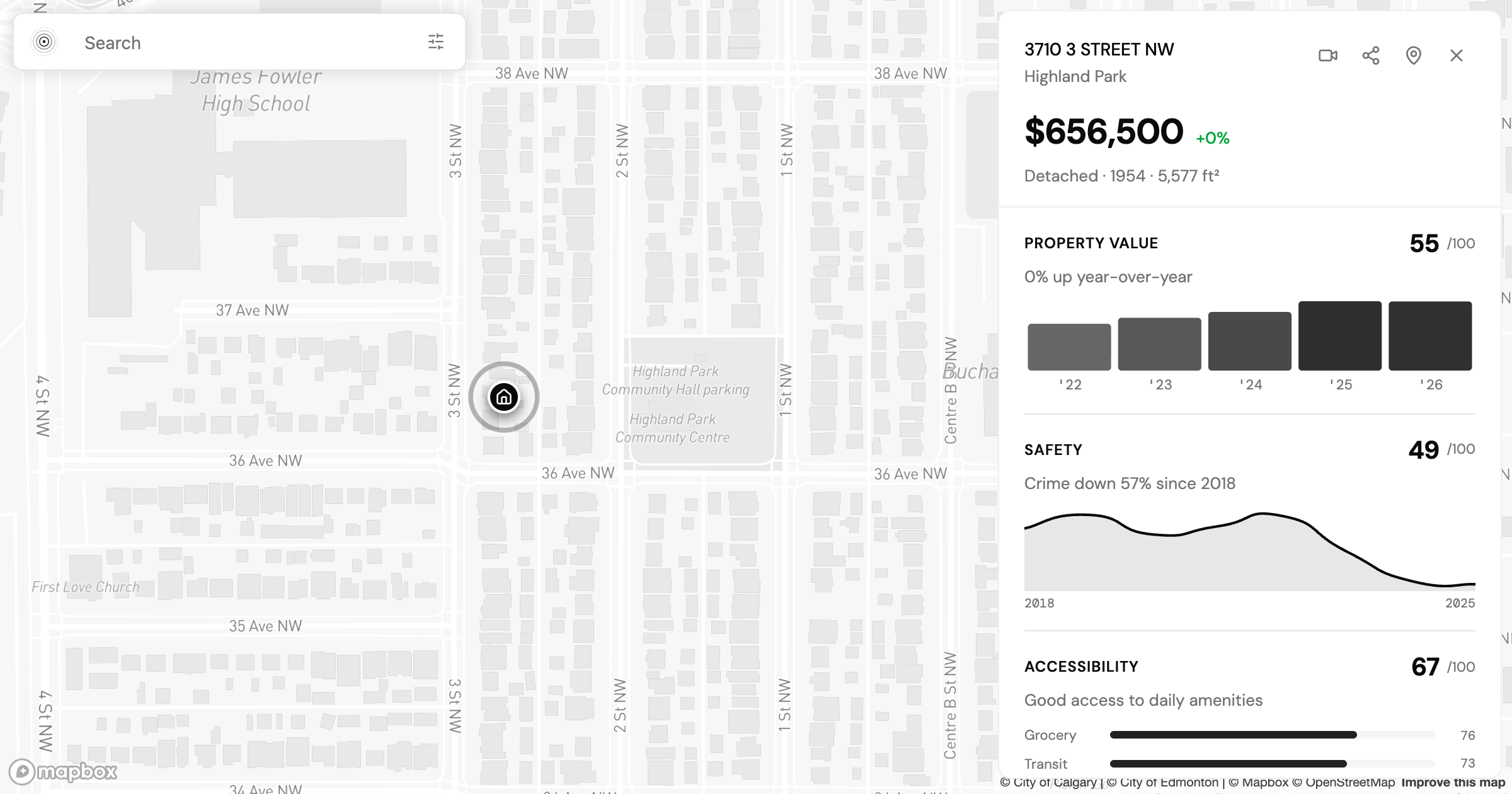
Is Highland Park Calgary Safe? Reading the Inner-North Crime Data
Is Highland Park Calgary safe? We pulled the Calgary Police crime data for this inner-north community and read a safety score of 49 category by category.
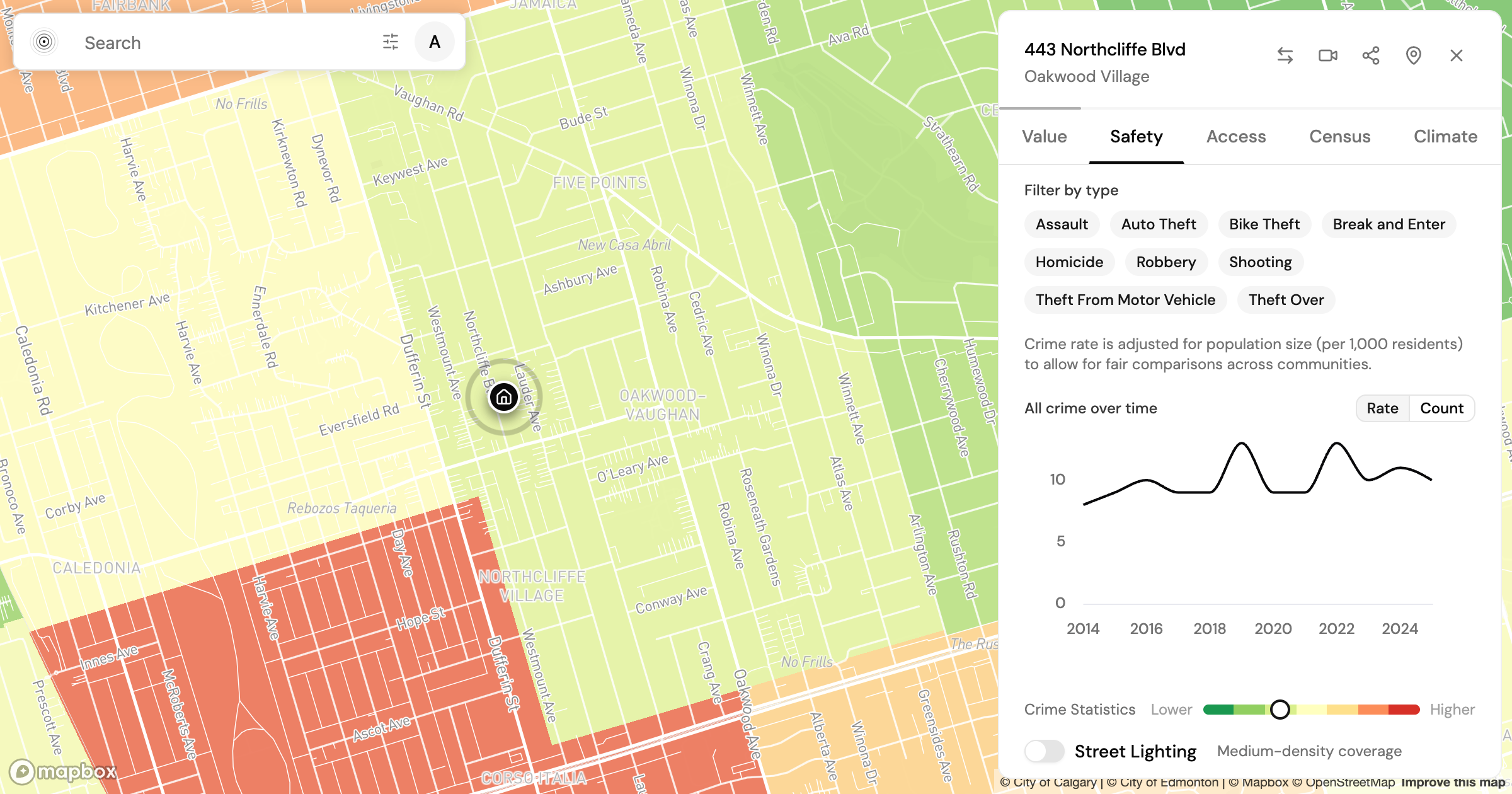
Is Oakwood Village Toronto Safe? What the Crime Data Shows
Is Oakwood Village Toronto safe? We read the Toronto Police crime data by category and trend to show how to turn a safety score into a question you can act on.
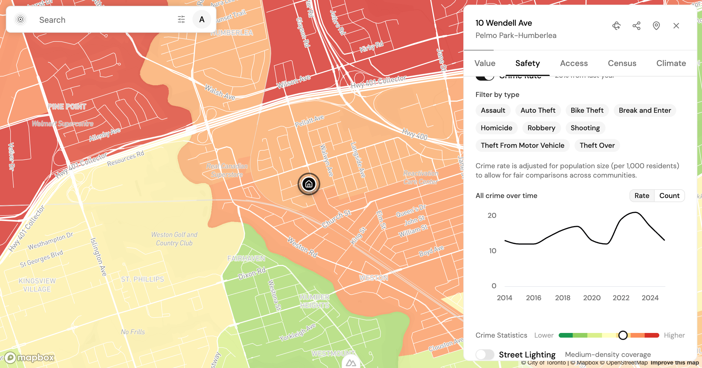
Is Pelmo Park-Humberlea Safe? How to Read Northwest Toronto's Crime Data Before You Buy
Is Pelmo Park-Humberlea safe? We read Toronto's 2025 crime data by category and trend to show how to weigh a northwest Toronto safety score before you buy.
Find my place
Tell us where you need to get to and we will route it on the real network, then rank the city on how well it serves that.
Find my place